


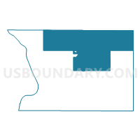
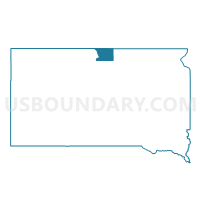
VTD-precinct 3, Campbell County, South Dakota
About
Outline

Summary
| Unique Area Identifier | 667092 |
| Name | VTD-precinct 3 |
| County | Campbell County |
| State | South Dakota |
| Area (square miles) | 226.79 |
| Land Area (square miles) | 224.37 |
| Water Area (square miles) | 2.42 |
| % of Land Area | 98.93 |
| % of Water Area | 1.07 |
| Latitude of the Internal Point | 45.87008330 |
| Longtitude of the Internal Point | -99.96534960 |
Maps

Graphs
Select a template below for downloading or customizing gragh for VTD-precinct 3, Campbell County, South Dakota


Neighbors
Neighoring Voting District (by Name) Neighboring Voting District on the Map
- Emmons 28-05 Voting District, Emmons County, ND
- McIntosh 28-06 Voting District, McIntosh County, ND
- VTD-Northwest precinct, McPherson County, SD
- VTD-precinct 1 Herreid City, Campbell County, SD
- VTD-precinct 2, Campbell County, SD
- VTD-precinct 4, Campbell County, SD
- VTD-precinct 5, Campbell County, SD
Top 10 Neighboring County Subdivision (by Population) Neighboring County Subdivision on the Map
- South Emmons UT, Emmons County, ND (820)
- Herreid city, Campbell County, SD (438)
- South Campbell UT, Campbell County, SD (364)
- North Campbell UT, Campbell County, SD (343)
- West McPherson UT, McPherson County, SD (271)
- Southwest McIntosh UT, McIntosh County, ND (257)
- Pollock town, Campbell County, SD (241)
- Artas town, Campbell County, SD (9)
Top 10 Neighboring Place (by Population) Neighboring Place on the Map
Top 10 Neighboring Elementary School District (by Population) Neighboring Elementary School District on the Map
Top 10 Neighboring Unified School District (by Population) Neighboring Unified School District on the Map
- Mobridge-Pollock School District 62-6, SD (4,318)
- Eureka School District 44-1, SD (1,305)
- Strasburg Public School District 15, ND (836)
- Herreid School District 10-1, SD (688)
- Zeeland Public School District 4, ND (280)
Top 10 Neighboring State Legislative District Lower Chamber (by Population) Neighboring State Legislative District Lower Chamber on the Map
Top 10 Neighboring State Legislative District Upper Chamber (by Population) Neighboring State Legislative District Upper Chamber on the Map
Top 10 Neighboring 111th Congressional District (by Population) Neighboring 111th Congressional District on the Map
Top 10 Neighboring Census Tract (by Population) Neighboring Census Tract on the Map
- Census Tract 9665, Emmons County, ND (3,550)
- Census Tract 9729, McIntosh County, ND (2,809)
- Census Tract 9631, McPherson County, SD (2,459)
- Census Tract 9641, Campbell County, SD (1,466)
Top 10 Neighboring 5-Digit ZIP Code Tabulation Area (by Population) Neighboring 5-Digit ZIP Code Tabulation Area on the Map
- 57437, SD (1,286)
- 58573, ND (674)
- 57632, SD (634)
- 57648, SD (335)
- 58542, ND (324)
- 58581, ND (258)
- 57646, SD (199)